
Acqua Alta

High Water in Venice:
a Brief Summary
Acqua Alta in December 1903 | Piazza S. Marco
As Venice recovers after its worst week of flooding since 1872 – tentatively mounting the massive clean-up operation – we’ve put together an article on acqua alta.
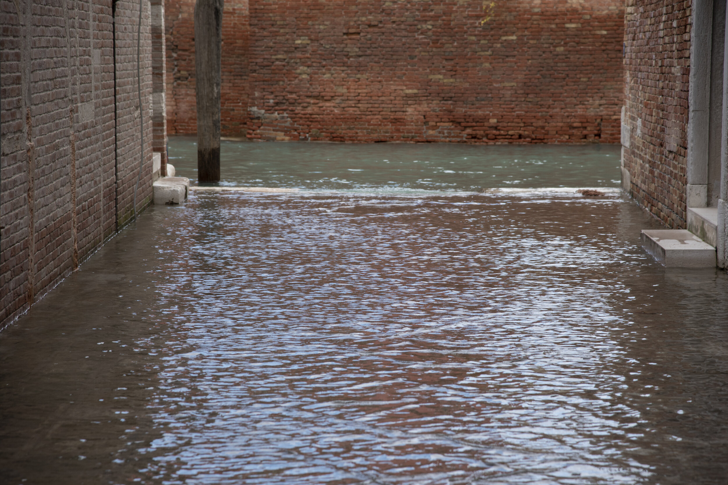
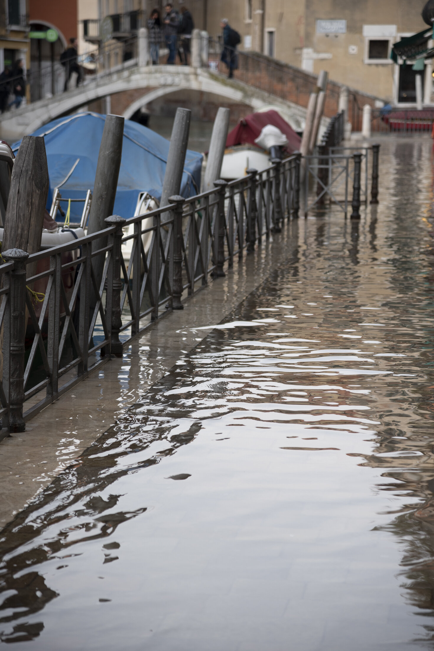
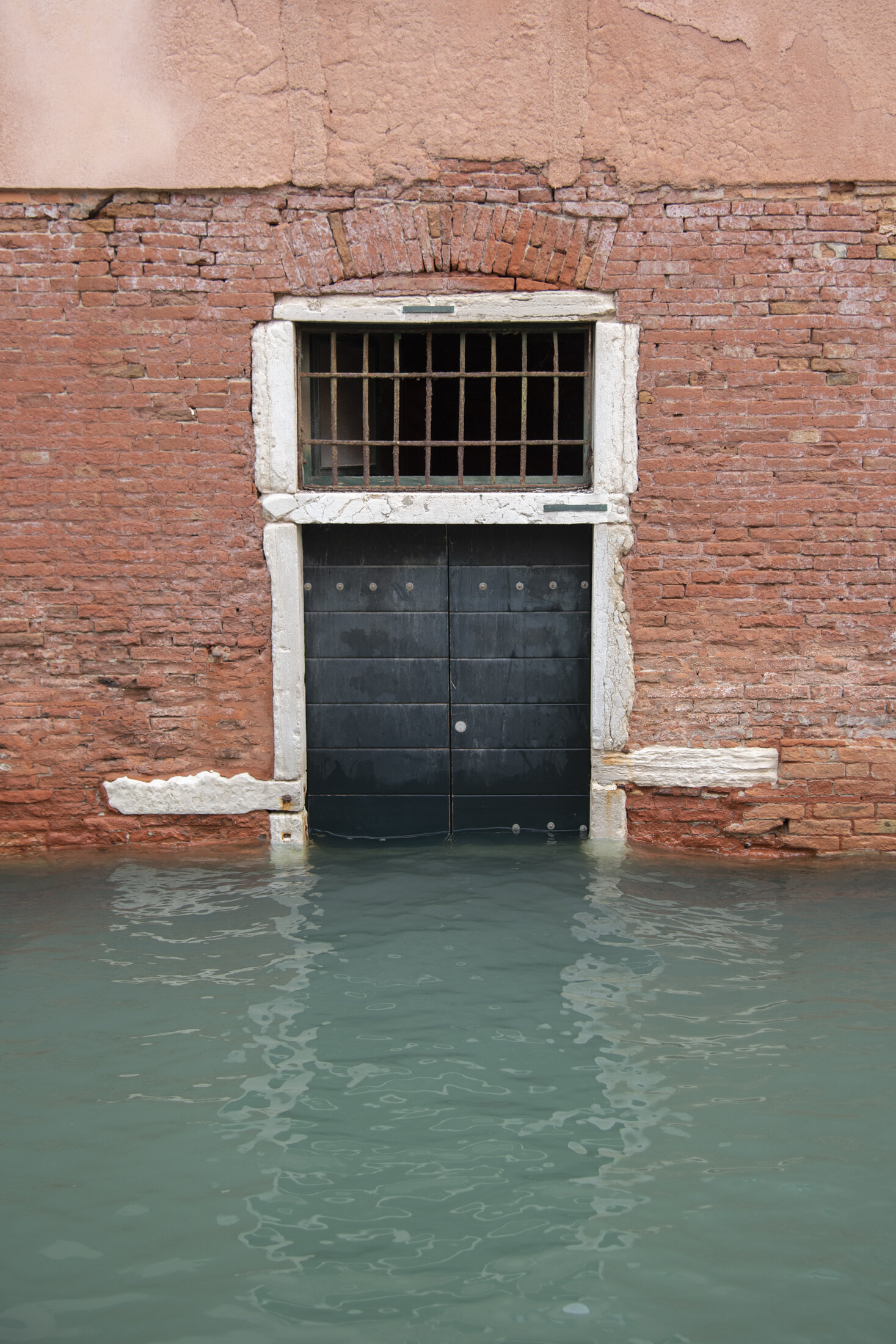
While typical episodes of acqua alta (high tide) are a natural phenomenon in the Venetian lagoon, last week’s extreme flooding must be considered “the result of climate change” – as stated by Venice’s mayor Luigi Brugnaro. Not since 1966 has water reached these levels, and not since records began has Venice endured such prolonged inundation.
The governor of the Veneto region, Luca Zaia, described the scene as one of “apocalyptic devastation”, saying the city was “on its knees”.
In our previous post we discussed the historic flooding of Florence in 1966. What we didn’t mention, was that on the very same day – November 4th 1966 – Venice also suffered a catastrophic deluge. Water levels reached 1.94 metres that day: the highest level since records began.
Since then, many episodes of acqua alta have occurred (even as I type, on November 16th & 17th) but last week, on November 12th & 13th flood levels in the lagoon city reached the second-highest level ever recorded: peaking at 1.87 metres on the evening of 12th November amid heavy rain.
According to The Guardian newspaper, ‘St Mark’s Square was submerged by more than a metre of water, while the adjacent basilica was flooded for only the sixth time in 1,200 years. The last occasion, in November 2018, caused an estimated 2.2 million Euros of damage.’
Carlo Alberto Tesserin, who heads up the team responsible for managing the historic centre, told Agence-France Presse that the water had surged into the basilica with a force “never seen before, not even in the 1966 flood”.
Warnings about increasingly high tides “went unheeded”, Tesserin said, adding that “the damage we see now is nothing compared to that within the walls. The salt enters the marble, the bricks, everywhere.”
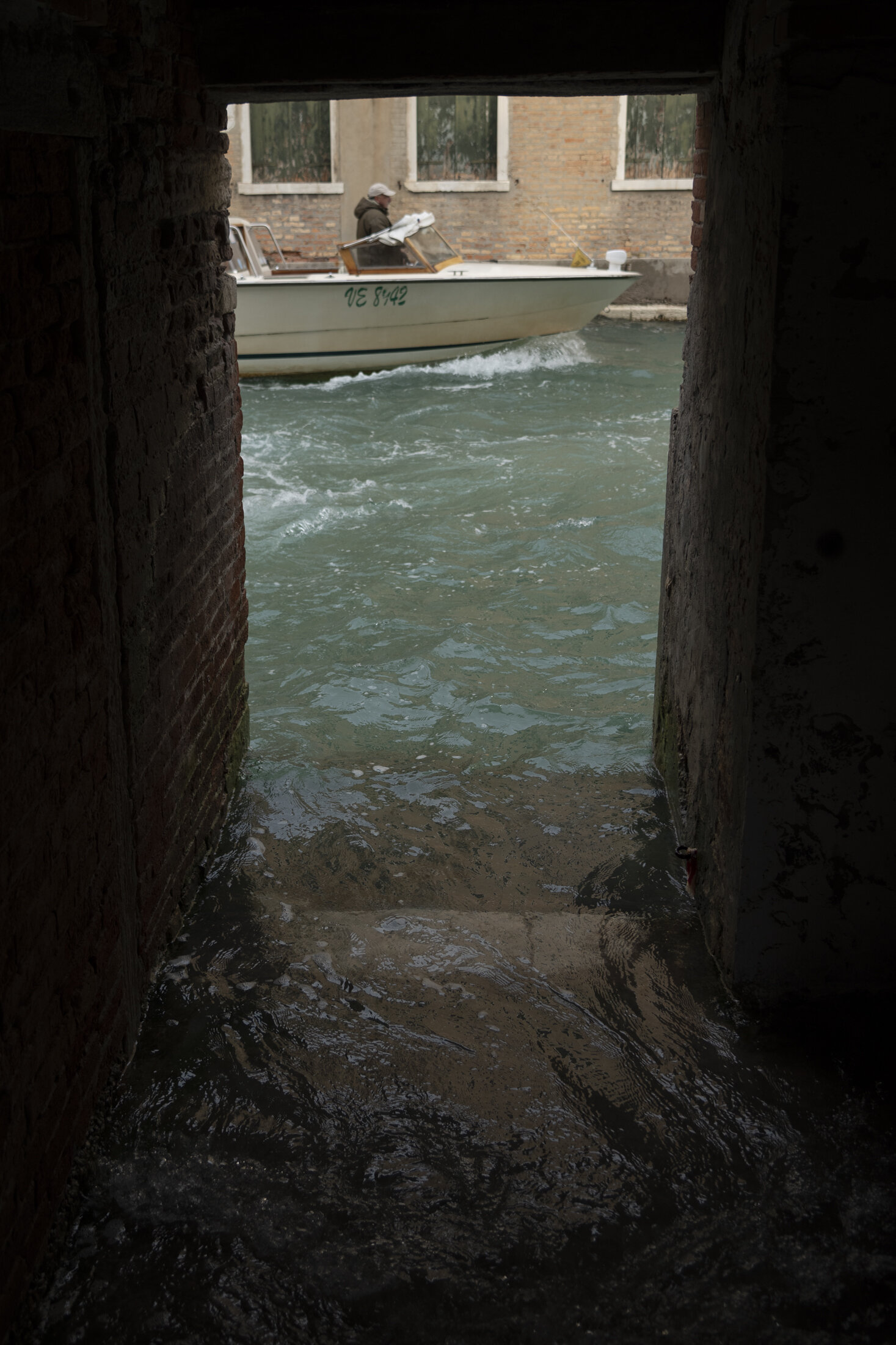
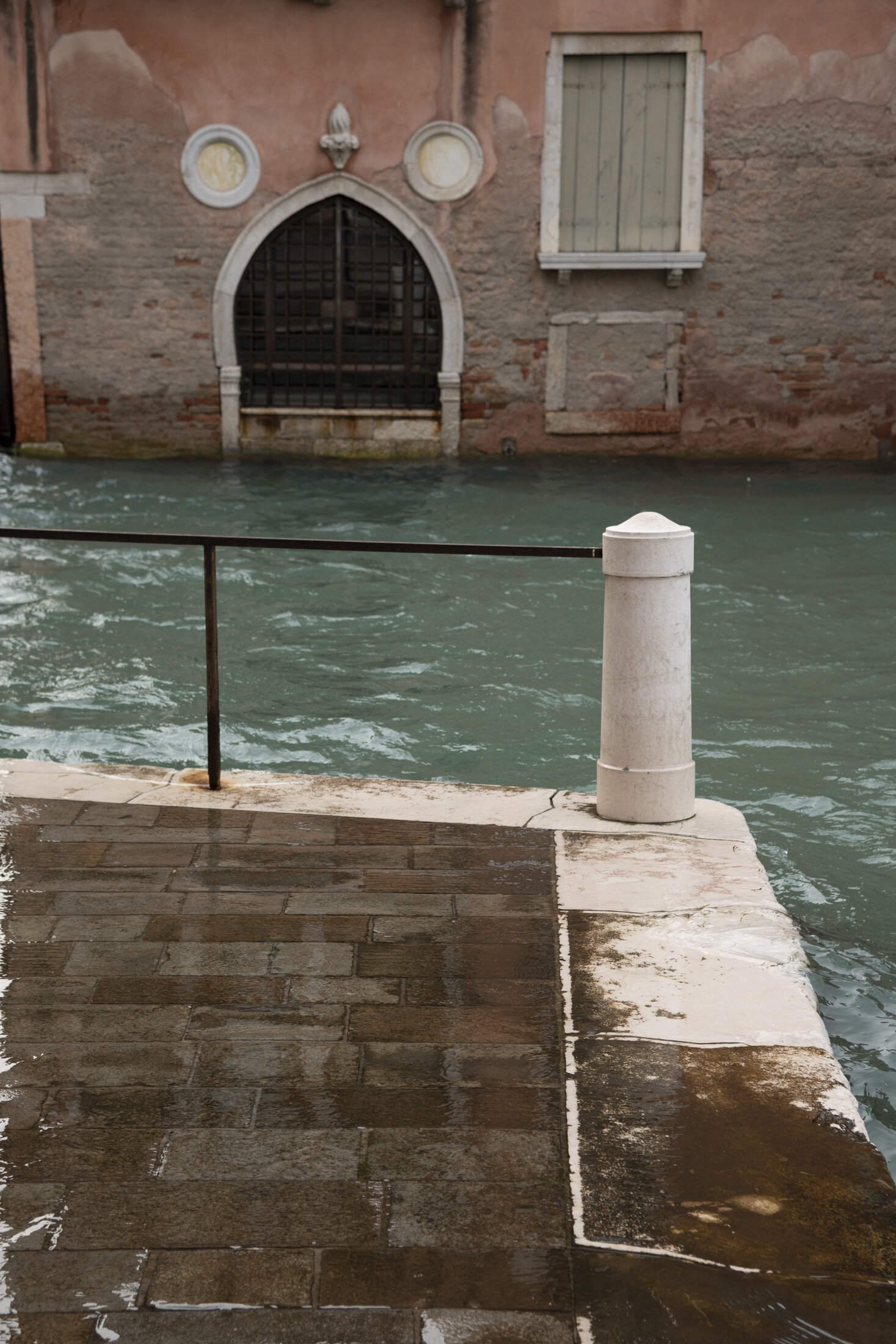
Episodes of high tide are a normal occurrence in the Veneto. Tides peak as they approach the Venetian Lagoon, where they regularly cause the partial flooding of Venice and Chioggia.
Flooding also occurs elsewhere around the northern Adriatic – at Grado and Trieste – though much less often. A typical episode of acqua alta will only submerge around ten percent of Venice; while last week’s inundated over eighty-five percent of the city. The phenomenon occurs mainly between autumn and spring, when the sirocco and bora winds blow northbound along the Adriatic Sea.
Venice is home to only fifty thousand full time residents. A significant population decrease has taken place in recent years as a result of both mass tourism and changing domestic conditions. The city is inundated by thirty-six million visitors every year, many arriving by cruise ship.


Often affectionately dubbed “the sinking city”, it might be easy to blame this factor for Venice’s ever-increasing episodes of extreme acqua alta. For they have increased: since 1872 there’s been twenty-one episodes of exceptionally high waters*. In line with accelerated levels of global sea rise, twelve of those events have occurred since the year 2000 alone. Perhaps, then, we ought to focus more on sea levels rising and increased climate change driven weather events than about Venice sinking.

Venice sits atop thousands of plunged wooden posts** within sediment deposits at the ancient mouth of the Po River (which is still compacting and settling). Early industrial projects, such as offshore piers and a bridge to the mainland affected the sea floor and tidal cycles, weakening the city at its foundations. Twentieth-century industry worsened things further: pumping out massive amounts of groundwater from the aquifer beneath the lagoon for nearly fifty years before the government stopped the practice in the seventies.
Venice is said to be sinking at rate of one millimetre per year. Meanwhile, sea levels in the Venetian lagoon are rising by 9.5mm per year, according to the most up to date data available†.
A 5.5 billion Euro sea wall was supposed to stop Venice from flooding. The project, known as MOSE, is ‘one of the largest civil engineering endeavours in the world’, according to Business Insider. La Stampa newspaper describes MOSE (an acronym for Modulo Sperimentale Elettromeccanico – Experimental Electromechanical Module) as a ‘system of retractable gates conceived long ago … to protect Venice and its inestimable artistic heritage from the high tides that invade the Lagoon from the Adriatic…’ but the reality of the construction project has been ‘truly an anthology of horrors’, instead of costing 1.6 billion Euro, it has already cost 5.5 billion; instead of going into service in 2011, if all goes well it won’t begin working until 2022.
The design consists of a series of mobile gates stationed at three different lagoon inlets. When the tide reaches forty three inches, the gates are designed to rise above the water's surface and protect the city from flooding. When the tide recedes, the gates lower back into place.
The total barrier spans one mile and weighs around three hundred tons. This massive project has, so far, been marred with controversy. Not only are those sections already built either debilitated by crustaceans and hampered by eroded hinges; but the project has been marked by ‘very serious episodes of corruption, sanctioned in a trial which has just ended and which revealed a frenzied activity of bribery to cover up work and plans that were bad in design and even worse in execution’ (La Stampa).
Venice’s previous mayor and a series of colleagues were arrested on corruption charges, suspected of embezzling around twenty million euros in public funds earmarked for the construction of the barrier.
“This is a climate emergency. This is sick governance of the city” said Jane Da Mosto, executive director of We Are Here Venice, a non-governmental organisation whose aim it is to keep Venice a living city as opposed to a museum-theme-park.
Extreme floods such as those seen in recent days – which used to occur in Venice once every hundred years – are expected to recur every six years by 2050, according to a recent report by the Intergovernmental Panel on Climate Change; by 2100, floods like this could happen every few weeks.
As author David Wallace-Wells observes in The Uninhabitable Earth, we’ve spent the millennia since Plato enamoured with a single drowned culture: Atlantis. ‘If Atlantis ever existed, it was probably a small archipelago of Mediterranean islands with a population of a few thousand. By 2100, if we do not halt emissions; as much as 5% of the world’s population will be flooded every single year.’
Is Venice set to be a future Atlantis?
Footnotes
* When settlers (refugees from the mainland) arrived on the site that would become Venice – around 400-402 AD – they were faced with the need for more space and stronger foundations to live upon. They had to find ways to strengthen the land. They dug out hundreds of canals and shored up the banks with wood pilings. They also used similar posts as foundations for their buildings. The settlers pounded hundreds of thousands of these piles into the mud, so close together that they were touching. They then cut off the tops and created solid platforms for the foundations of their homes. Because the wood is underwater, it didn’t rot. Infact, the wood petrified, so that the material today is closer to stone than it is to wood.
** Extreme episodes of acqua alta are categorised as follows:
Intense – when the measured sea level is between 80 cm and 109 cm above the standard sea level (which was defined by averaging the measurements of sea level during the year 1897);
Very intense – when the measured sea level is between 110 cm and 139 cm above the standard;
Exceptional high waters – when the measured sea level reaches or exceeds 140 cm above the standard.
† The figure stated here comes from measurements taken in Venice between 2001 and 2015 (the most up to date we can find). We know that since 1993 global sea levels have accelerated (according to the 2018 BAMS State of the Climate report) but Venice’s case is extreme. Between the period 1909 to 2000 local sea level raised, on average, 2.43mm per year (taken from NOAA data). From 2001 to 2015 the sea here has risen by 133mm / 9.5mm per year (taken from PSMSL data).
Further Reading
Venice has no official plan for how to tackle climate change
Flooding in Venice could be preview of things to come for coastal cities
Venice flooding: salt threatens frescoes and paintings
Venice still waiting for Moses to hold back the seas
Vulnerability of Venice exposed by devastating series of floods
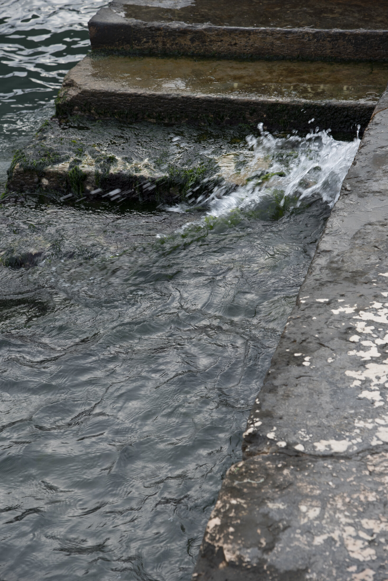
The postcard featured above was printed in 1903, and comes from David Cass' collection of Venice ephemera.The image can be considered within the public domain based on its age. Other photographs were taken on an A La Luz trip to Venice in 2015, during a typical episode of aqua alta


